Home
| Family Pictures | What's
Tom up to? | Rogues Gallery | Climbing Pictures | Anne's Art
| Vacation Photo Album | Website
Links | Contact Me
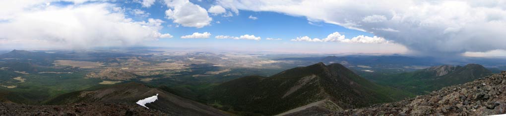
Summit Panorama looking Northwest through East
 |
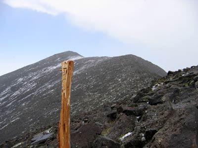
Hiking up Mt. Humphreys
SNOW!!!
 |
I decided to hike up Mt. Humphreys, so after finishing up some business I filled up my backpack and drove to the Ski Bowl trailhead (elevation about 9300 ft.). When I got there, I discovered my water bladder was leaking. I found a tiny hole where some critter had chewed at it. Luckily I had a 2 liter gatorade bottle with me. So I tried to sop up the water on my bag and repacked with the wet part of my pants hanging out to dry and started up around 10:30. Soon things clouded up, but I continued on up the trail in the forest. Eventually the clouds got darker, and I could no longer pretend that the noise I heard was only jet aircraft, it was definitely thunder. Maybe I should have checked the weather before heading out. In the previous month in Flagstaff, I had only seen rain over the San Francisco peaks one other day, so it was a bit out of the ordinary. I was well under the elevation of the peaks and ridges, and figured I could handle getting soaked, so I continued hiking up. Things got cooler, and windier, and the thunder was rumbling nearly continuously with a few sharp cracks also. At this point I figured I'd stop at the first decent overlook and then head down after that. Well, About the time I got to a decent overlook, there was a bit of precipitation. sleet. I put on my long underwear top and kept heading upwards, and soon there was a lot of graupel flying through the air. (graupel is the sort of snow that looks like little styrofoam balls). The rumbling of the thunder seemed to be moving away as well as having a longer gap between episodes. As I approached the ridge line it was really coming down sideways. I pulled on my long pants and kept heading up. Soon I was above treeline and traversing up near the ridgeline. In places the wind was blowing the snow up the slope hard enough that it was painful on exposed skin. The thunder was nearly gone, and definitely had moved off to the east. The snow stopped shortly before I got to the summit (it was already tapering off when I took the picture here). Shortly after I got there, the sun began to threaten to shine through weakly and the snow was melting fast. Maybe it was just as well I didn't check the weather after all. The storm had moved off to the east, and made a nice view. It took me just under 3 hours to make the 4.5 to 5 miles up to the 12,643 ft. summit, the highest point in Arizona.
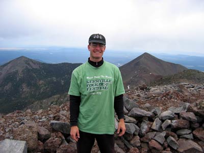
obligatory summit shot
(Flagstaff behind my left shoulder)
 |
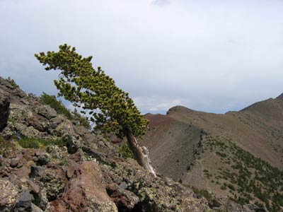
Harsh winds result in leaning trees and
krumholtz near treeline
 |
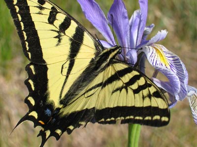
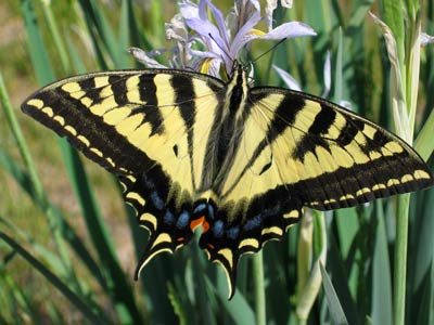
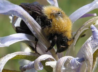
After taking a bunch of photos and eating some lunch, I started down. Lots of downhill here. My knees weren't particularly pleased with me. The sun came out, and I had to remove the layers I had added as I lost altitude. When I hiked across the ski run near the bottom, there were a lot of insects working the iris flowers, so I stopped to take a lot of pictures. It was hard to get the butterflies before they moved, but I got a few decent shots.
I was pleased that the altitude didn't seem to bother me at all, I guess living at 7,000 feet gets you partly acclimated. My leg muscles didn't seem as bothered as I feared they would, but my knees were not pleased with me. I suppose if my legs were in better shape, maybe my knees would get pounded less, but all in all I felt pretty good about the hike.
Pale Swallowtail Butterfly (Papilio eurymedon)
 |
yet another butterfly
 |
Bumblebee
 |
Summitpost's site on this mountain
Peakware's page on Mt.Humphreys