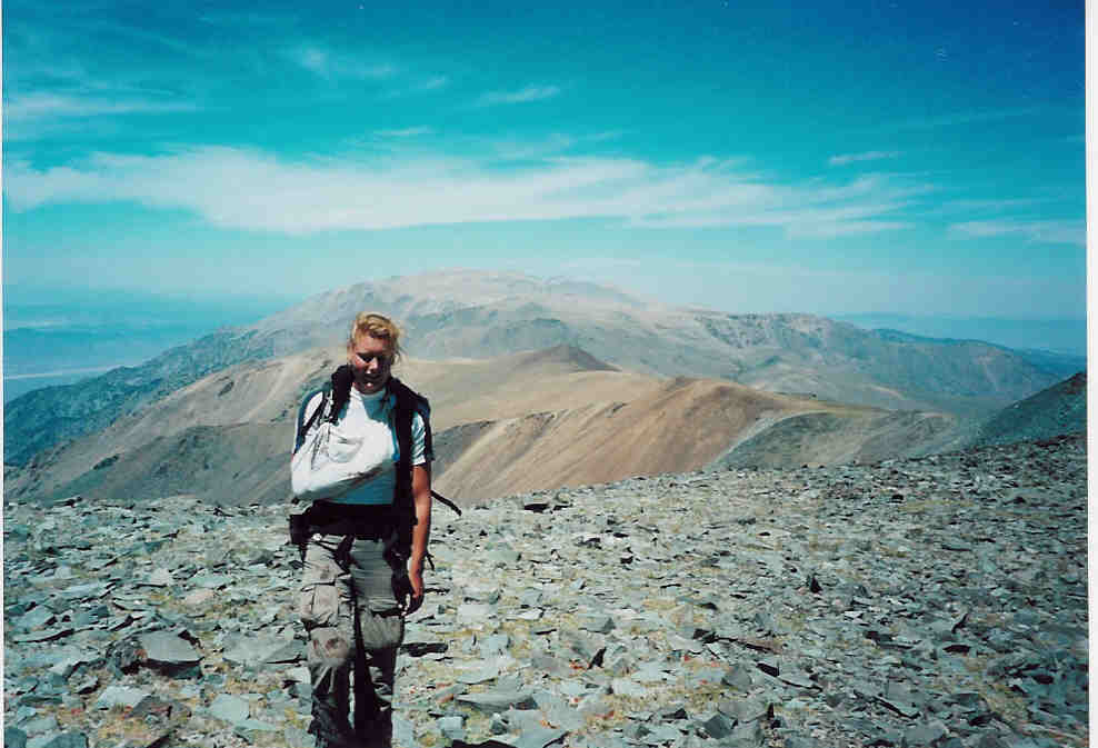
(we covered nearly all the ground behind her)
Home | Family Pictures | What's Tom up to? | Rogues Gallery | Climbing Pictures | Anne's Art | Vacation Photo Album | Favorite Links | Contact Me
I wanted to traverse along the spine of the White mountains north to Boundary Peak, the highest peak in Nevada. I scouted a bit of the scrambling north of white mountain peak with Chris a few days earlier so I knew that would go. Marieke wanted to go also, so we planned to leave Wednesday after she finished feeding, cleaning, and weighing the research puppies. Unfortunately the nitrogen ran out while Maarten was doing the controlled breathing study on Monday, so they had to redo his test on Wednesday when a new nitrogen tank was delivered… What this means is we didn’t leave until 12:30.
We hiked up to the snowfield on White Mountain where we would head north off of the trail. We took a short detour up to the summit (14,242 ish), and then ate our lunches and headed onto the scrambling. This was more of a pain than I expected, partly because of loose talus, and partly because of the packs. From there we headed north across broad rockfields, dropped down and crossed more loose talus, and traversed below 2 more small peaks on interesting metasedimentary rocks (metaconglomerates, phyllite, and slate among others). Then we were on a wide sloping tableland. Finally we had a descent down to Birch creek, dropping over 1600 feet before surprising three deer and heading up a fork of the creek. We camped near the head of the creek when it got dark and we found a reasonably rock free flat spot. Unfortunately when we stopped and went to put on warm clothes, Marieke’s fleece jacket was missing, it had fallen out from under some straps on her pack. It was a lot of hiking for an afternoon, about 11 miles straight line, and we did not hike in a straight line. We were definitely ready to stop before we did.
On Thursday we got up fairly early and were hiking about 7. We took Marieke’s pack nearly empty and the lid of my backpack as a fanny pack which we traded off. We hiked up to Pellisier flats, more broad gently sloping rocky fields with short alpine vegetation. We saw some groups of bighorn sheep and deer off in the distance while hiking along these high alpine fields. Eventually we made it up to point 13,500 and then Mt. Dubois (a small pile of rocks that was the highest point for a ways at 13,559 ft.) The summit register was plastered with stickers from the naval weapons center, and we assumed the occasional rumble we heard came from military testing or training. The sky was clear, so we assumed it wasn’t lightning, which would have had a severe impact on our schedule. Beyond Dubois the ridgeline narrowed and became more rocky eventually coming to the “jumpoff” where we had to drop down 1,200 feet to the saddle before Montgomery peak. This was more steep loose scree, not my favorite at all (although looking up from the bottom we could see I didn’t choose the best route).
Montgomery Peak was more rocky than most of what we had been on, and the south ridge had a number of spires we would have to traverse around. Marieke was intimidated by it and had a bad feeling. I was somewhat frustrated as I was a bit tired, and we were running out of time. I figured we would have to turn around by 2 to have any hope of making it back before complete darkness. It was after noon when we left the saddle. Marieke decided that she would go at a slower pace and just try to get up Montgomery, so I took the fanny pack and took off. Scrambling fast, I managed to get to the summit of Montgomery (13,441’) quickly sign the register and be on my way by 12:55. I dropped down (more scrambling) and headed up the ridge to Boundary Peak (13,140) about .75 miles to the northeast getting there just before 1:30 and leaving at 1:32. I didn’t make as good time back to Montgomery Peak, and Marieke wasn’t at the summit when I got there. I checked the register, and she hadn’t been there, so I hoped she had just decided to relax. I called her name occasionally on the way down, and tried to look down the gullies in case she had slipped, and wondered what I would do if I didn’t find her. Eventually I saw one of her bootprints heading down, and a short while later she heard me rattling down a gully around a pinnacle. Then we headed down to the saddle just before 3:00.
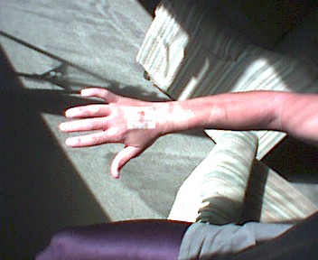
She was just behind me on a rather ugly bit of traversing when I heard a crash and her screaming. She was sliding down a steep slope with a big rock on her arm pushing her down. After 20 or 30 feet she stopped, and I ran/slid down a few feet to the side and rolled the rock off of her. (it was about 2.5 feet by 1.5 feet by 1 foot and roughly teardrop shaped.) I later learned she had grabbed it and it pulled off of the wall and started the whole mess. Things weren’t looking so good, although what I first thought was blood soaking one leg was water from a camelback that had lost it’s mouthpiece. The worst wound was on the back of her right hand. A deep gash just under 2 cm long (it looked sort of like a bit of raw chicken inside, with a tendon visible). There were also some deep scrapes on the inside of her right wrist, and a cut inside her right elbow. I rinsed/washed out the worst gashes and tried to close the wound on the back of her hand, but it didn’t want to stay shut. Eventually duct tape seemed to work, although it kept bleeding at a much reduced rate. In addition to the aforementioned major wounds, there were small scrapes and abrasions all over her right arm, on her right cheek, right ear, and the right side of her butt (and ripped pants).
After doing what first aid we could, we got off of Montgomery. At the saddle we redid the dressing on the back of her hand and then started up the endless talus to the jumpoff. This is where my energy was at it’s lowest. However the much reduced pace I had was about the speed Marieke could go, so it wasn’t a problem. Finally we got to the top where we redid the dressing again (this is where we finally resorted to the duct tape), ate and drank a bit, and then headed on. I must have really needed the food and water, as I felt much better afterwards. (although the more level hiking helped too). From there it was just a matter of plodding on and on and occasionally eating a cookie and sipping some water. Our water supply was reduced by the spill and using some to wash the wounds, but I still had to keep telling Marieke to drink. It was getting about dark when we left Pellisier flats. It was really dark when we got down by the creek. When I pulled my penlight out to look at the altimeter, it barely glowed, but scraping the terminal brought it back to life. We knew we were close to camp, and sure enough, we walked right up to the tent a few minutes later around 9 pm. First I got water. Then I cleaned up Marieke’s arm. The stars were amazing. Then I cooked dinner while she napped. Then we ate a bit, and I cleaned and picked sand out of her butt. Then we finally got some much needed rest.
The next morning we didn’t get up quite as early, but still before 7. It took quite some time to cook and pack up everything by myself. Nearly everything fit into my backpack, which was handy. It was still lighter than it had been on the Picket traverse. Finally we left a little before 9 am. The hike back was relatively uneventful. Just long and tedious and stressful. We looked for the fleece jacket, but didn’t have much luck. The motto was “every step is one less step” which seemed to work.
|
|
|---|
Although this trip was pretty grim (at least for the second half). It could have been a lot worse too. It would have been a rather exhausting 3 day trip, and 2.5 days with an injury made it more of a marathon than a hike. Still, we got to see some amazing views, and some cool wildlife. I didn’t really mention that for almost the entire trip either the Sierras or some mountains in Nevada were visible as well as the valleys to either side. Today (Saturday) might turn out to be a 100 meter day (where I try not to walk more than 100 meters at a stretch) as I am still a bit sore and have some backpack bruising and chafing.
Later... Marieke turned out ok, although she did have an infection in her hand
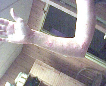 Marieke's arm 8-25-01
 Marieke's arm 8-25-01
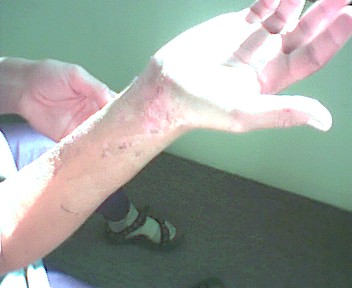 Marieke's wrist 8-25-01
Boundary Peak link from summitpost
Montgomery link from summitpost
White Mountain link from Summitpost